
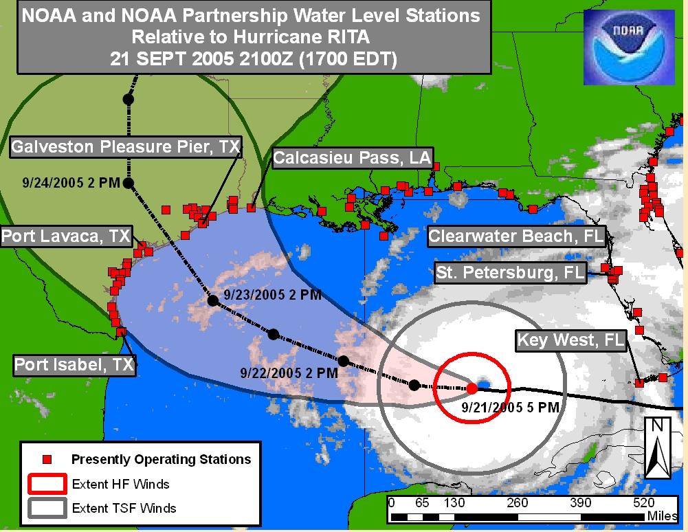
This map is buried in the NHC links via NOAA. You can try this link to find it along with other storms. I think it gives a good relationship between Rita and the hurricane's possible path.
HF means Hurricane Force and TSF is Tropical Storm Force. For Rita, HF extends out to 70 miles while TSF extends 175 miles. Rita's pressure right now is 897 mb pressure and still moving west.
Best estimate for landfall is Saturday morning with Galveston close to the center lane. Pray for all the people of Texas and the evacuees from Louisiana who are now living in Houston and facing another hurricane.
2 comments:
Good morning Anna, I'm still here reading you site, it's hard to leave a comment when you cover all topic so well.
AndyJ
Oh Andy. *^_^* Thank you!
Will strive to keep up such excellence then.
Post a Comment